Skip to content
mengare discovery
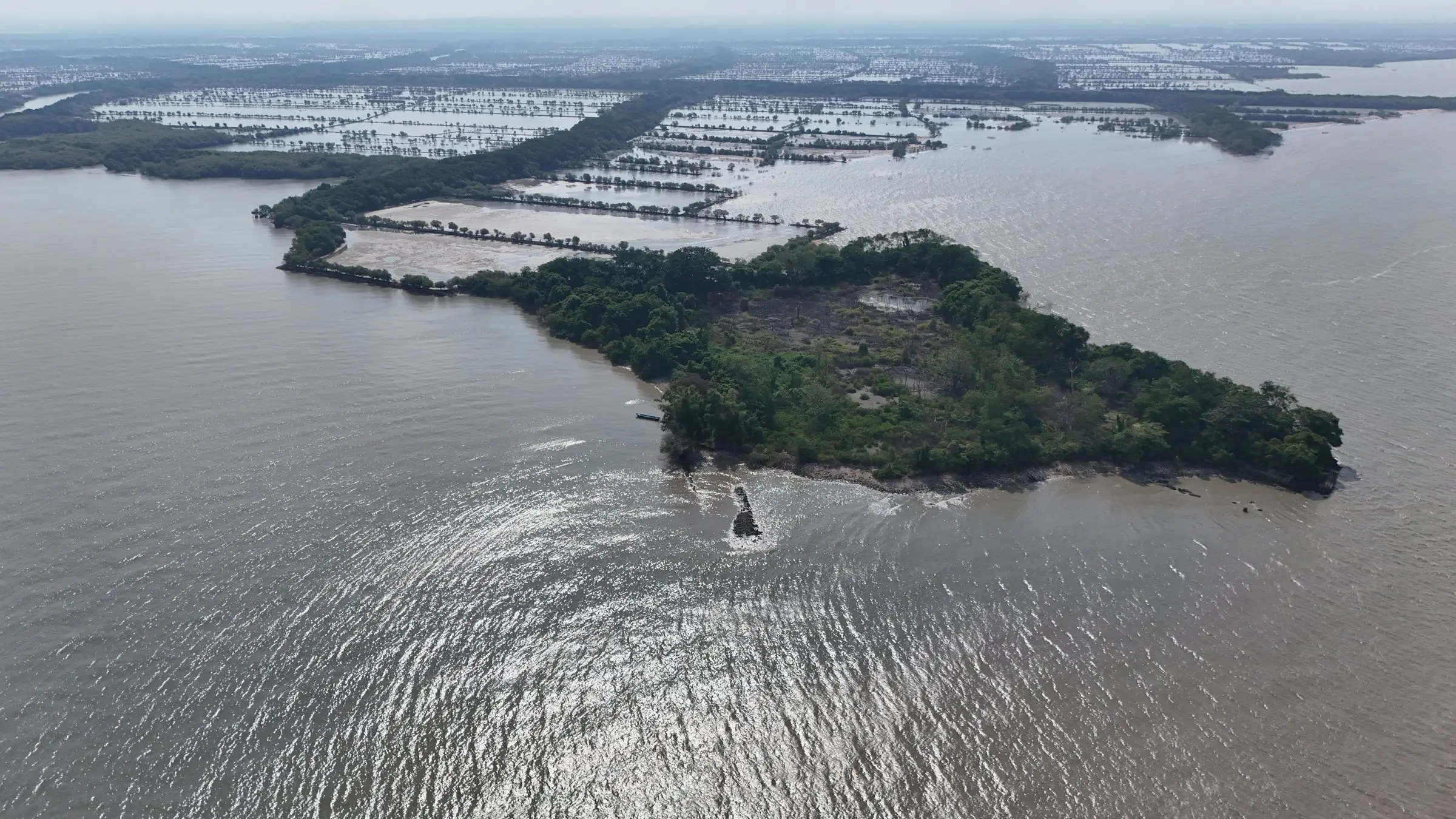
Aerial view of a small mangrove island in the waters around Mengare, with aquaculture ponds behind

Restoration programme

Restoring the Mengare coast

We restore the physical conditions of the habitat first, so mangroves can grow back on their own.

2026 Restoration Programme

The new restoration site consists of former aquaculture ponds whose dykes have been eroded, near the Fort Lodewijk area. On the surface, shell and sand form unstable mounds that the waves keep shifting. The wave direction changes with the seasonal monsoon winds. A constantly moving substrate prevents seedlings from anchoring and establishing. The first stage of the 2026 programme is therefore the construction of a sediment trap.

The design is based on observations at several points along the Mengare coast. There, accumulated shell has formed ridges (shell ridges), with mangroves growing on their landward side. The mangrove roots stabilise the ridge so that the material does not disperse; the ridge becomes more compact and higher, and acts as a natural wave attenuator. The sediment trap is designed to set off the same process gradually.

The approach is ecological mangrove rehabilitation (EMR) within a nature-based solutions framework. The physical conditions of the habitat, namely substrate stability and tidal exchange, are restored first so that mangroves can regenerate naturally. Planting is the last option, used only once the growing conditions are met and natural recruitment is insufficient. The programme target is therefore expressed as restored area (5.4 ha), not planted area. The sediment trap is permeable: sediment is retained while seawater continues to flow in and out with the tide.

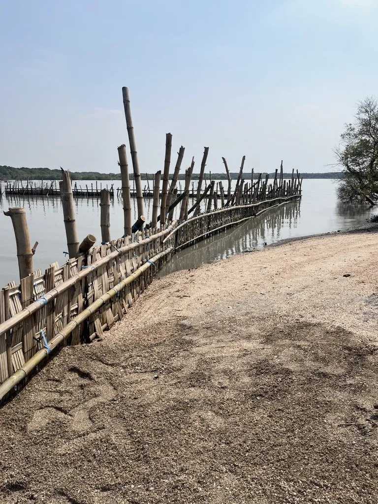
The woven-bamboo sediment trap, with sand and shell starting to collect on the landward side
Woven-bamboo sediment trap, 2026. Sand and shell have begun to accumulate on the landward side.

Our principle

Mangrove rehabilitation is not the same as planting mangroves. Planting is the last option and never the end goal.

  1. 01

    Elevation

    ground elevation relative to the tidal range where mangroves grow

  2. 02

    Hydrology

    seawater flows in and out freely with the tide

  3. 03

    Stable substrate

    sediment is no longer shifted by waves

  4. 04

    Propagule supply

    propagules from nearby mangroves can arrive and settle naturally

Planting is done only where these conditions are met but natural recruitment is still insufficient.

  1. 1

    Sediment trap

    A 121 m woven-bamboo structure is set across the path of the wave-driven shell and sand before any planting. The structure is permeable, so tidal exchange continues.

  2. 2

    Sediment accumulation

    Trapped material stops dispersing and accumulates gradually, raising the elevation of the ridge.

  3. 3

    Enrichment planting

    Planting is supplementary: 1 ha of Avicennia marina in the more sheltered area, and Rhizophora apiculata and R. stylosa propagules along the pond dykes. Once habitat conditions are suitable, natural regeneration is expected across the 5.4 ha target area.

  4. 4

    Natural wave attenuation

    Mangrove roots stabilise the ridge, and the ridge shelters the stand behind it. Together they form a natural wave-attenuating system.

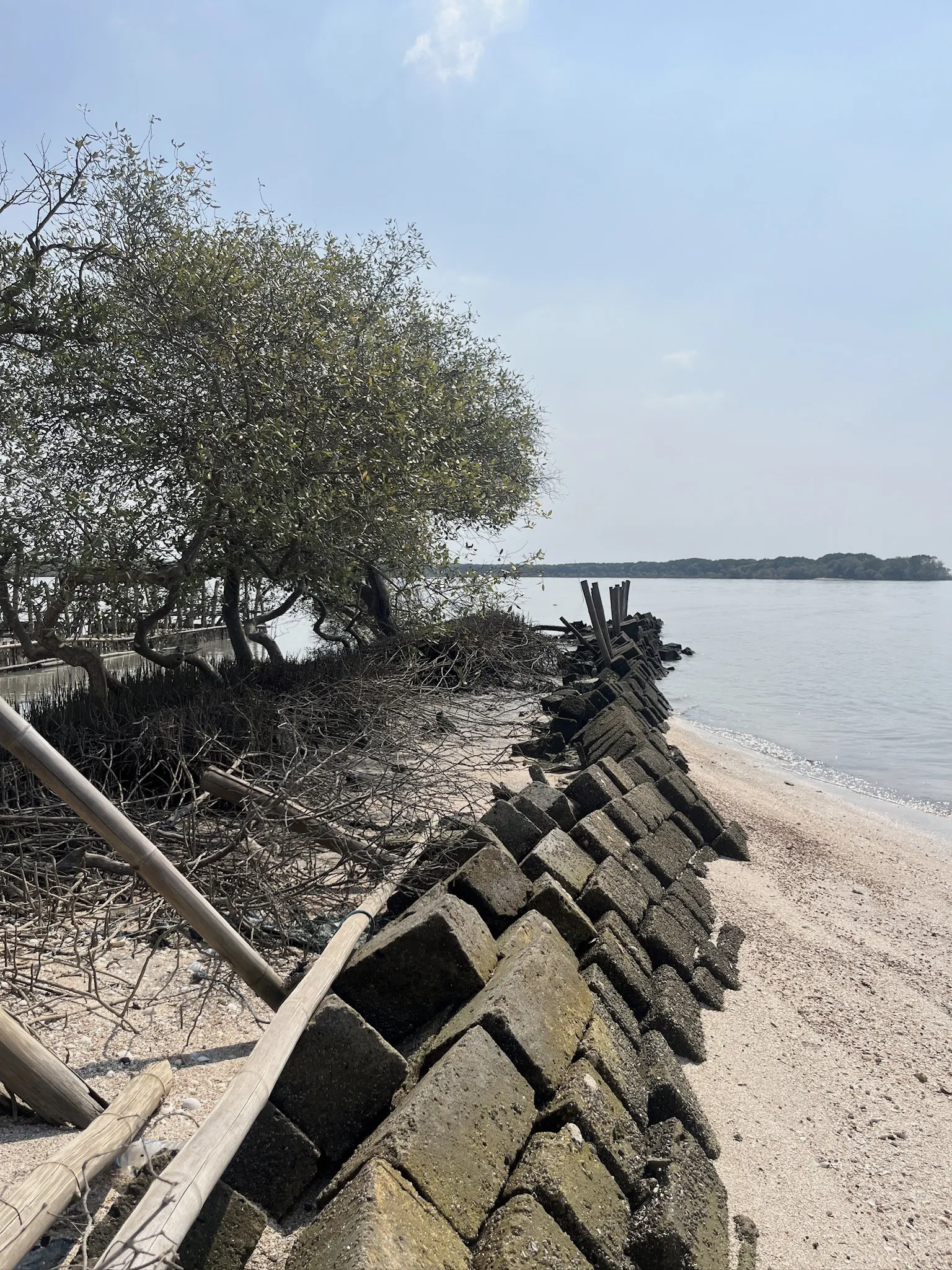
The concrete-block dyke of an old aquaculture pond, broken up by erosion
Initial condition: an eroded pond dyke.
The sediment trap seen from the shore, with newly planted propagules in front
Newly planted propagules on the sheltered side of the trap.
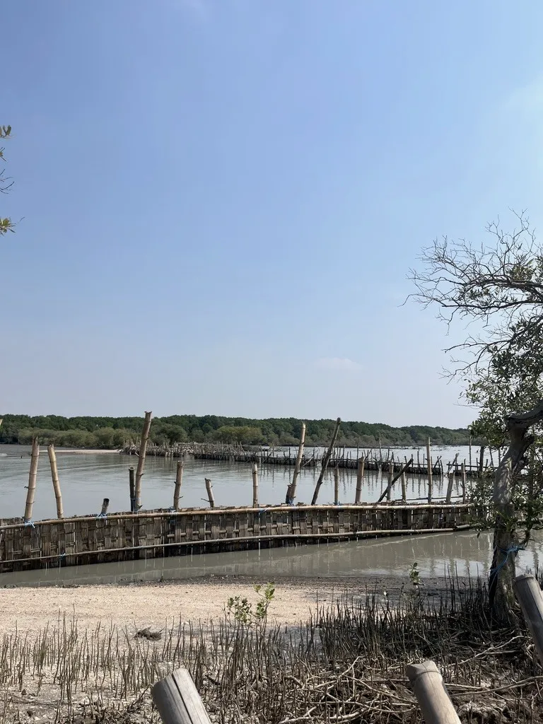
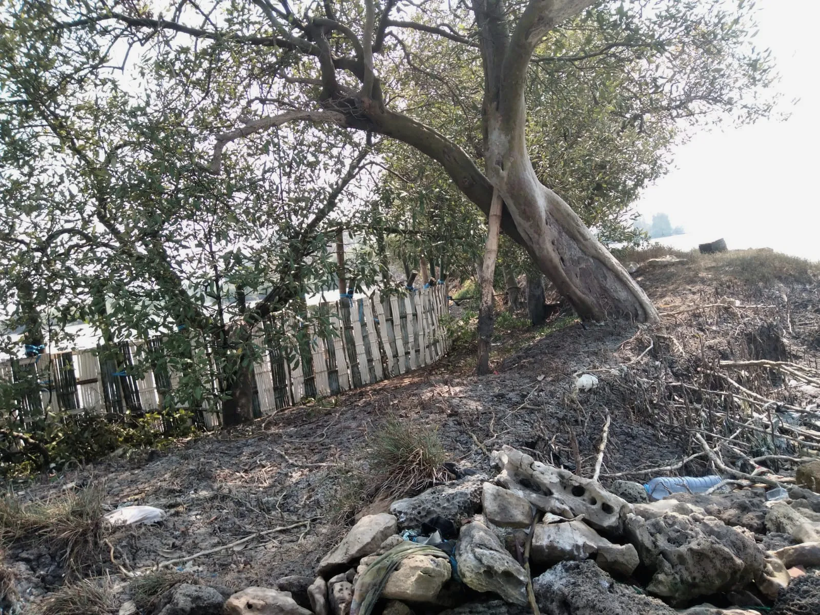
The bamboo sediment trap at a corner of the pond dyke, among older mangroves
The same site from a corner of the pond dyke.
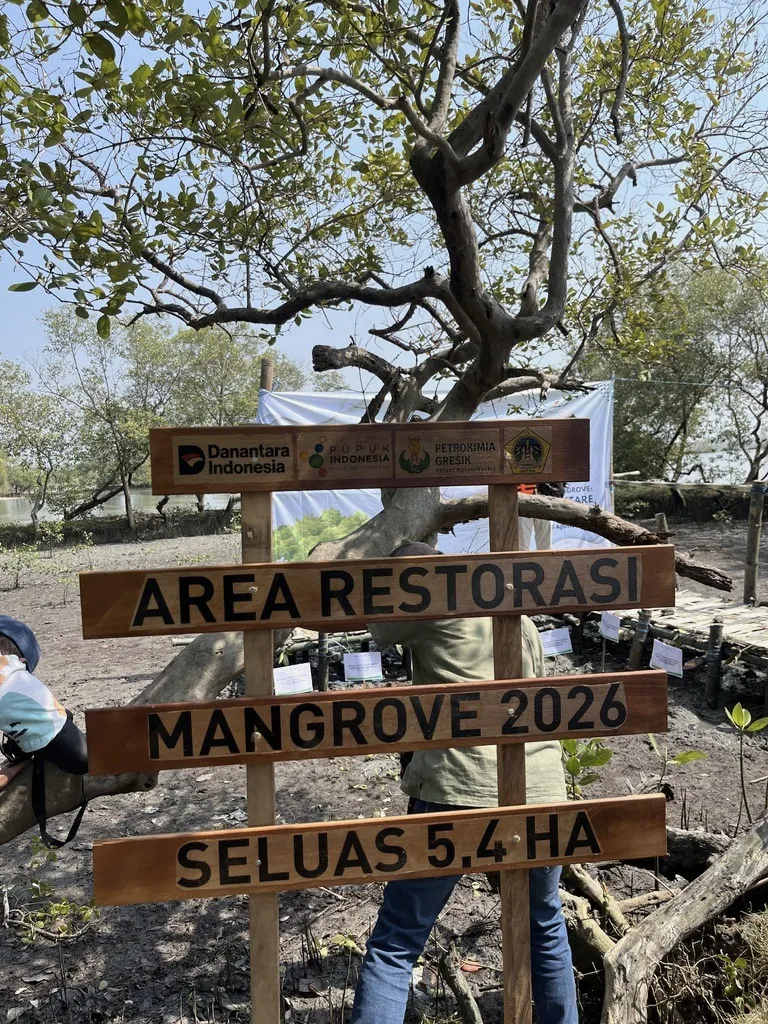
Sign at the new mangrove restoration site, 2026, with a 5.4 ha target
The new site: a 5.4 ha restoration target.

Progress

The 2026 works on the map

We map each activity in the field and update this map each time a stage is completed.

  1. 2026 restoration target area

    Target area: 5.4 ha

    Area engineered into suitable habitat for natural mangrove regeneration; not all of it is planted.

  2. 2026 sediment trap

    Length: 121 m

    A permeable woven-bamboo structure built before planting to retain shell and sand moved by waves, whose direction changes with the monsoon.

  3. 2026 Avicennia marina planting

    Area planted: 1.0 ha

    Enrichment planting of Avicennia marina over 1 ha within the target area.

  4. 2026 Rhizophora planting on pond dykes

    Length: ±1,550 m

    Propagules of Rhizophora apiculata and R. stylosa planted along the dykes of abandoned aquaculture ponds.

  5. Fort Lodewijk area

    Area: 4.8 ha

    The area of the Daendels-era fort (1808) near the new restoration site. Shown for reference; not part of the restoration works.

Positions from field mapping; areas computed from the mapped boundaries. Base map: Esri World Imagery.

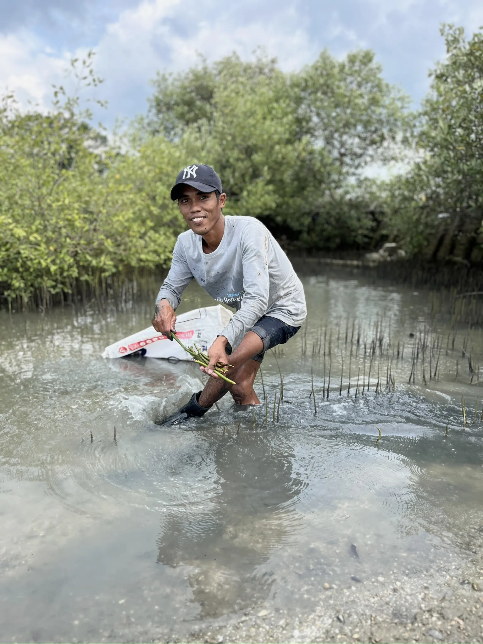
A local planter pressing propagules into the mud at the 2026 restoration site
Manual planting of propagules at the 2026 site.

Restoration practice

What has been done here

Each practice is listed with its year, what it was meant to solve, how it works and where it stands now.

Hybrid engineering

Problem
Plantings in 2009, 2010 and 2015 were washed away on the open shore, and civil-engineered pond dykes could not withstand the waves.
How it works
A permeable breakwater of local bamboo poles, on average 4 m tall, filled with Avicennia branches left over from the natural feed farmers soak in their ponds. Seawater passes through, waves break and weaken, and mud settles behind it. It closed the gaps between old stone pond dykes, in directions set using local fishers' knowledge of waves and currents. The design follows the Building with Nature project of Wetlands International Indonesia.
Weakness
The structure does not last long.
Status
Built once.

Staged planting on eroded ponds

How it works
Planting in stages with pioneer species, from sheltered to more open ground. In 2018 a first bamboo boardwalk was built to monitor the seedlings.
Result
Mangrove cover grew from 5.01 ha (2019) to 7.34 ha (2026).
Scale
  • 2018: 3.23 ha planted
  • 2019: a further 3.28 ha
  • 2024–2026: about 1 ha a year on eroded ponds to the north
Status
Ongoing.

Woven-bamboo sediment trap

Problem
At the new site near Fort Lodewijk, waves keep moving shell and sand, so seedlings cannot anchor.
How it works
A permeable woven-bamboo structure holds the moving material while seawater still flows in and out with the tide. The aim is to rebuild a stable shell ridge where mangroves can regenerate naturally.
Scale
  • Target: 5.4 ha of restored area
Status
Ongoing.

Enrichment planting

How it works
Supplementary planting where natural recruitment is not enough.
Scale
  • 1 ha of Avicennia marina
Status
Ongoing.

The restoration is carried out by the site managers, Pokmaswas and Pokdarwis Tanjung Widoro, in collaboration with the Gresik Regency Environment Agency (Dinas Lingkungan Hidup) and the Tanjung Widoro Village Government.

Social-ecological impact of the programme →

The full story, with photos year by year →

Support the next stage

Companies, schools and communities can take part in the rehabilitation at the new site: building and monitoring the sediment trap, enrichment planting where the conditions are ready, and tracking natural regeneration.

  1. Rehabilitation area since 2018

    Rehabilitation area: 13.3 ha

    The PRPM Mengare area where rehabilitation has run since 2018. This is the extent of the rehabilitation area, distinct from the planted area (±9.5 ha) and canopy cover (7.34 ha in 2026).

Positions from field mapping; areas computed from the mapped boundaries. Base map: Esri World Imagery.

Supported by

Danantara IndonesiaPupuk IndonesiaPetrokimia GresikTJSL Petrokimia GresikPokmaswas Tanjung WidoroPokdarwis Tanjung WidoroDinas Lingkungan Hidup Kabupaten GresikPemerintah Desa Tanjung WidoroAgrie ConservationEcosains IndonesiaGresik Naturalist